Location / Region

Back to the HOME page:
Back to the MILLHOUSE website:

Riverside Tourer Park
is located on the outskirts of the rural hamlet of MILLHOUSE.
1.5 miles from the village of Hesket Newmarket,
3 miles from the village of Caldbeck.
We are the nearest touring Caravan and Motor home park to the unique walking and cycling opportunities of the virtually undiscovered eastern side of the Northern Fells, just a hop, skip and a jump from the hustle and bustle of the busy commercialised parts of the Lake District.
yet only, (an easy, wide and straight) 15 minutes from J41 of the M6 Motorway.
Our hamlet of MILLHOUSE
& the site is only (9 miles) 15 minutes from junction 41 of the M6 Motorway.
Mid point, (as the crow flies) between Keswick and the Border city of Carlisle.
Central to the towns of:- Keswick, Carlisle, Penrith, Cockermouth and Wigton.
Nearest Lakes:- Ullswater, Derwent Water, Thirlmere and Bassenthwaite.
All the above mentioned towns and lakes are within a 30 minute journey from the site.

Alfred Wainwright
A.W. loved solitude during fell walking.
That's why he especially loved the Northern Fells. 

Book number five, from "Alfred Wainwright", in his "Pictorial Guide to the Lakeland Fells"
(The Northern Fells) features with great detail, most of the potential walks of our Local fells.
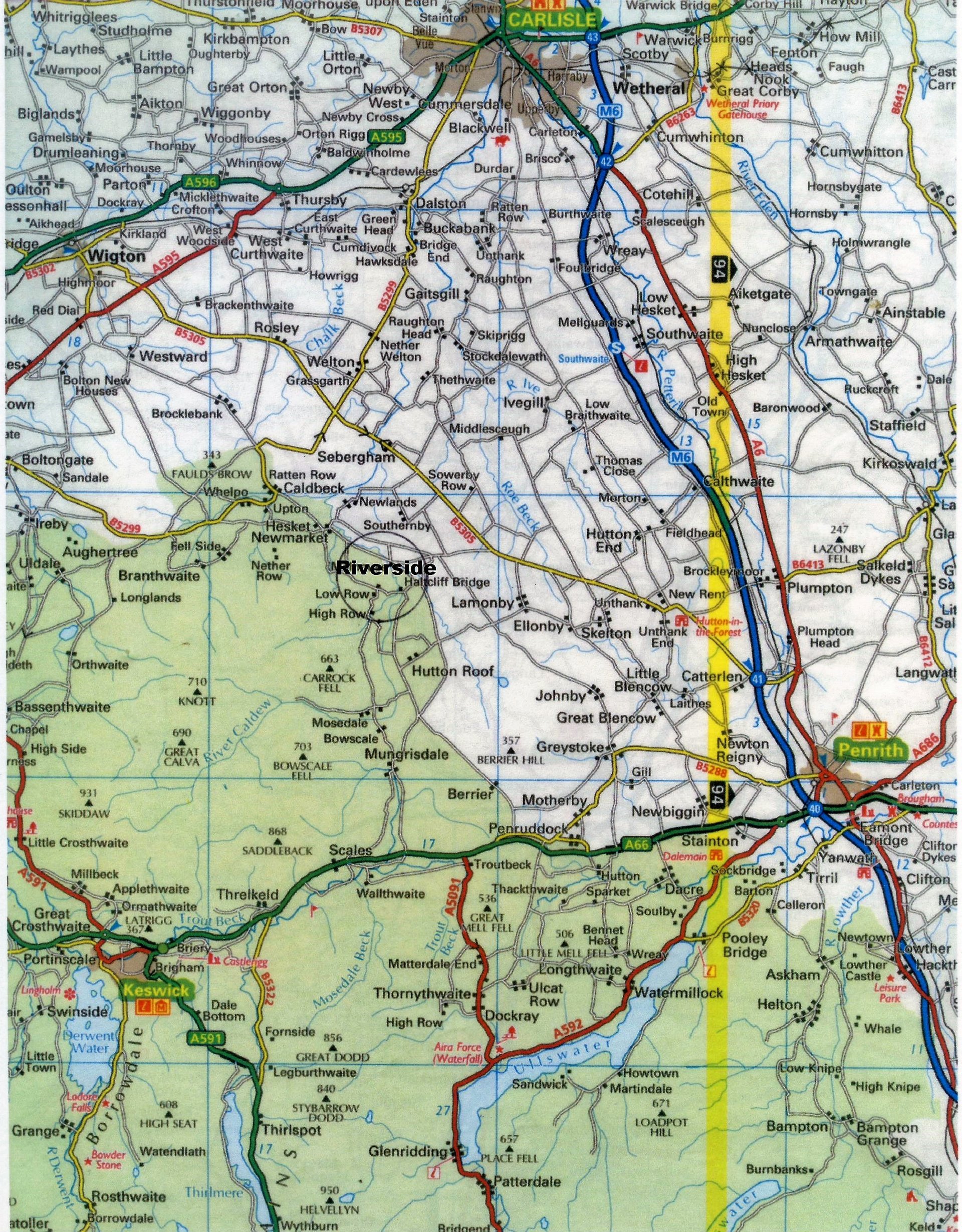
There's more about the Northern Fells on this website link. Our Hamlet of MILLHOUSE,
is shown on the top right corner of the Map.
The nearest Lakeland Fells, the Northern Fells ( Carrock, High Pike, Binsey, Bowscale, Blencathra/Saddeback, Southerfell, Mungrisedale Common, Bannerdale Crags, Knott, Great Calva, and Skiddaw ) are only 10 minutes drive from the site.
Visit this website to view pictorial details of 27 walks of the Northern Fells:- http://josweeney.net/walks/northern-fells/
We are the nearest touring Caravan and Motorhome park to these unique walking opportunities of the Eastern side of the Northern Fells.
Yet only, (an easy, wide and straight) 15 minutes from J41 of the M6 Motorway.
Yet only, (an easy, wide and straight) 15 minutes from J41 of the M6 Motorway.
Caldbeck "open" Common Land.
(Only a short drive from the site).
This is Calebrack,
(pronounced "Kalebreck").
A popular Wainwright walk starting point for both Carrock and High Pike.


"Caldbeck Common"
offers unique un-rivalled walking opportunities, both strenuous and non-strenuous.
You may park your car where-ever you wish on the wide grass verge of the unfenced road. Just be careful not to obstruct the road or an access.
You may park your car where-ever you wish on the wide grass verge of the unfenced road. Just be careful not to obstruct the road or an access.
The Northern Fells are popular with walkers who prefer the quietness, and discovering virtually untrodden territory, with no problems parking the car.
The Northern Fells still have to be discovered by most.
Most other parts of the Lake District used to be like ours, until they were commercialized.
The Northern Fells still have to be discovered by most.
Most other parts of the Lake District used to be like ours, until they were commercialized.

Unlike the mid and southern parts of the lake District, which have become rather overwhelmed with mass tourism during the high season, our area has retained its unique un-developed, un-spoilt, natural, scenic character, which is unlikely to change because of the lack of visitor accommodation and commercial gimmicks.

The Picturesque, glaciation formed "Swineside valley",
which is accessed by road from Mosedale village, is a very worthwhile visit during your stay at Riverside.
The valley has a public tarmac road, (narrow in places) which runs parallel with a rocky, scenic, infant stage of the River Caldew, leading to the head, where the last underground mineral mine of the Northern Fells, (Carrock Mine) was worked right up to the mid 1980's.
The valley has a public tarmac road, (narrow in places) which runs parallel with a rocky, scenic, infant stage of the River Caldew, leading to the head, where the last underground mineral mine of the Northern Fells, (Carrock Mine) was worked right up to the mid 1980's.
During its heyday in the 17th century, this area of the Northern Fells was the richest mineral mining area of the British Isles. It probably still is, and the minerals are probably still in there. It's just not viable to get them out. It's now popular with geologists and mineralogists. Fragments of rare minerals, even tourmaline crystals and gold, have been found in the rivers at the head of Swineside valley.
This was also the location of one of the country's main Wolframite ore mines,
(better known as Tungsten) during World War One.
The Tungsten ore was smelted into war ammunition, also light bulb filaments.


Above, is a drone photo by Malcolm & June Cavanagh taken during their stay last year.

The head of Swineside valley is a popular starting point for walking Coomb Height, Knott, Great Calva, and High Pike.
You can also join the "Cumbria Way" to Keswick via Skiddaw Forest and Skiddaw.
At the head of Swineside valley you can join the "Cumbria Way"
towards the eastern face of Skiddaw.
(The 4th highest mountain in England, 3053ft)
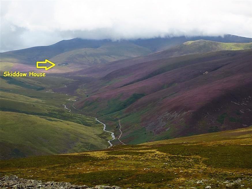
On the area of moorland known as Skiddaw Forest, the highest altitude youth hostel bunkhouse in Britain is situated, in complete isolation,
(1550ft above sea level).
"Skiddaw House". (shown below)


"Skiddaw House". A former estate owned "Shooting Lodge", used then by aristocracy.
Following extensive repairs and restoration to it's former glory, it's now used by the Youth Hostel Association. Remotely located on Skiddaw Forrest, it's over three miles, (of rough terrain), from any form of civilisation or road.
Following extensive repairs and restoration to it's former glory, it's now used by the Youth Hostel Association. Remotely located on Skiddaw Forrest, it's over three miles, (of rough terrain), from any form of civilisation or road.

Please note, that because of the remoteness and isolation of Skiddaw House, it has no mains Electricity, no mains Water, and no Gas.
Therefore, unfortunately has no facilities for providing tea and snacks for walkers who pass-by, so keep to plan "A", and carry the packed lunch and a flask with you.
This area, (Skiddaw Forrest) is the sourse of our river, the River Caldew.
Another rewarding steep gradient walk with a starting point from the Roundhouse in Swineside valley is "Bowscale Tarn".
"The tarn of the immortal fish" (according to William Wordsworth).
(See the "walklakes" link below)


Historically and rather uniquely, Bowscale Tarn has been naturally carved out of the hillside by glaciation during the ice age, to what can be described as a shape similar to a swallows nest. Its been reported to have a maximum depth of 50ft (17mtrs).
There's also a rather longer route to the tarn, but with a more gentle, less energetic gradient.
It's a purposely constructed Bridleway from Bowscale village, created in Victorian times to enable ascent by horseback.


Carrock Fell,
which has a summit of just over 2000ft.
(Only a short drive from the site).
Old Carrock End Copper Mine.
A popular walk starting point with readers of the Wainwright books Book number five, Carrock Fell 8. Ascent from Stone Ends.


Because some of the Northern Fells are on the very edge of the Lake District, by climbing the eastern face of Carrock, (or many of the other local fells), you are then rewarded by uniquie long range agricultural flat-land views.
This photo was taken at a point, only a fraction of the full ascent of Carrock, and even at this early stage, the pennines, (40 miles away) can be seen on the horizon.
This photo was taken at a point, only a fraction of the full ascent of Carrock, and even at this early stage, the pennines, (40 miles away) can be seen on the horizon.
Swineside Valley
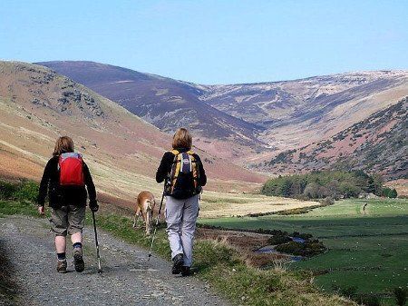
Our local roads are virtually traffic free, therefore ideal for cycling, as well as walking.


The river Caldew,
(The same river that flows past the caravan park)
shown here in it's infant stage, on the steep gradient of Swineside valley.
Knott, domineers the sky line.
The river Caldew sources just a few miles from this point on Skiddaw Forrest.

This is the bridge which spans Grainsgill Beck
at the head of Swineside valley,
This bridge is used by local farmers, but also carries the Cumbrian Way footpath which originates at Ulverston in the south, via the Lake District, to Carlisle in the north.
Knott is again shown domineering the sky line.
This bridge is used by local farmers, but also carries the Cumbrian Way footpath which originates at Ulverston in the south, via the Lake District, to Carlisle in the north.
Knott is again shown domineering the sky line.


High Pike.
The Memorial seat on the summit.
Extensive views of the Solway Firth and Southern Scotland can be rellished from here on a clear day.


Ascent of Blencathra,
with Sharpe Edge on the Sky-Line.
with Sharpe Edge on the Sky-Line.
One of the most popular, but challenging walks of the Northern fells is Blencathra.
A popular Wainwright starting point from Scales, leads up to Scales Tarn, from where there is a choice of two ascents. One of them being Sharp edge.
If you intend to walk Sharp Edge,
to be safe, its recommended that you do it on the ascent, and not the decent, and most importantly on a calm clear day.

Sharpe Edge. One of the most challenging scrambles, of not only the Northern Fells, but the whole of the Lake District. Only for the brave and Nimble. Not for the faint hearted. http://where2walk.co.uk/lake_district/classic_circuits/blencathra-via-sharp-edge/

Catbells.
This is probably one of the most popular walks of the Lake District.
We can't promise solitude on this walk, but what is certain, you'll be rewarded with some of the best scenery and lake views in the whole of the Lake District, & UK.
Dominating the distant back-drop is Skiddaw, Dodd and Ullock Pike, + Bassethwaite Lake.
Shown here at the foot of Cat Bells is Derwent Water, only 15 road miles from the site. Quite a lot nearer if you walk it, via the Cumbrian Way.


Derwent Water
& Friars Cragg,
with Catbells as the back-drop.
This photo was taken from the lake shore walk which originates at the Keswick landing stages.


For more walks in the Lake District visit this website by John Harris :


